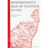
Bryant’s 1826 detailed 10 miles to 12.25 inches in A4 book format.
£9.50
Bryant’s 1826 map of Norfolk stands between Faden’s map of 1797 and the first Ordnance Survey map of 1836-7, but has certain features by which it may be clearly distinguished from either: it shows parish boundaries, it is on a scale of 10 miles to 12.25 inches (very close to the scale of the present day Landranger OS maps) allowing more detail of roads, buildings and parks to be shown, and for many parts of the county it is the first post enclosure map.
This Larks Press edition was first published in 1998 and is printed in softback book A4 landscape format, with an introduction by J.C. (Chris) Barringer.


This website uses cookies to ensure you get the best experience on our website. Find out more.