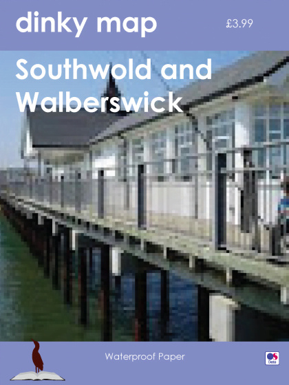
£3.99
More than 30 in stock
Dinky Maps are printed on both sides of an A3 sheet of waterproof paper that folds down to A6 – durable and 4x stronger than paper. Based on Ordnance Survey 1:25,000 scale cartography, with built up areas enlarged to 1:16,000, they provide a compact map focused on key areas for tourism and outdoor activities. This map covers the Suffolk coast from Southwold to Dunwich and is ideal for walks in the area.
Southwold, a famous Suffolk resort with its much photographed pier and beach huts. Park for free by Southwold Common golf course and walk down by the river passing the Harbour Inn and fish stalls before coming back into town, or cross the bridge to visit Walberswick for lunch at one of the pubs or cafés such as the wonderful Parish Lantern. To the south is Dunwich with its museum dedicated to the old town lost to the sea and Dunwich Heath and beach run by the National Trust.


This website uses cookies to ensure you get the best experience on our website. Find out more.