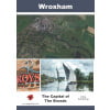
Dinky Map Wroxham, Horning and Coltishall

Dinky Map Wroxham, Horning and Coltishall

£3.99

In stock

Categories: Broads, Dinky

Description

Printed on both sides of an A3 waterproof sheet folded to A6, Dinky Maps are durable and stronger than paper. Based on Ordnance Survey 1:25,000 scale cartography enlarged to 1:16,000, this map covers Wroxham, Hoveton, Horning, Coltishall, Horstead, Salhouse and Ranworth.

Reviews

There are no reviews yet.

Be the first to review “Dinky Map Wroxham, Horning and Coltishall”

Your email address will not be published. Required fields are marked *

Related Titles

The Northern Broads
£12.99
Broads Park Rangers Favourite Walks
£6.99
Broadland
Broadland: Luminous Landscapes and Wide Horizons
£4.95
Wroxham: The Capital of The Broads
£4.95
Anything from a Pin to an Elephant: Tales of Norfolk Retail
Anything from a Pin to an Elephant
£15.99
Heron Waterways Map - The Broads
£5.99
OS Explorer Leisure Map OL40 - The Broads Norfolk and Suffolk
£12.99

This website uses cookies to ensure you get the best experience on our website.  Find out more.