Peddars Way and Norfolk Coast Path

Harvey National Trail Map

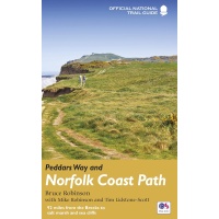
Tough, 100% waterproof trail map for the Peddars Way and Norfolk Coast long distance footpaths.

Peddars Way and Norfolk Coast Path
Harvey National Trail Map
Map

£15.95

19 available in stock

Description

The Peddars Way and Norfolk Coast Path is considered by many to be one of the most accessible National Trails, making it a perfect trail for first time long-distance walkers, or one for the winter months due to Norfolk’s dry climate.

Linking the forests and heathland of the Brecks with the coast, Peddars Way is steeped in ancient legend. It offers a wonderfully remote-feeling adventure with some spectacular historic sites to visit along the way.

The Norfolk Coast Path is a beautiful walk among sand dunes, marshes and Nature Reserves. It goes through the North Norfolk Area of Oustanding Natural Beauty and has some of the best birdwatching in the UK.

Combining both Peddars Way and the Norfolk Coast Path is a moderate long-distance walk that takes most people 7-10 days to complete but can be easily broken into shorter walks.

This map covers both routes:
Peddars Way – Knettishall Heath to Holme-next-the-Sea, 74km (46 miles)
Norfolk Coast Path – Hunstanton to Hopton on Sea, 134km (83.5 miles)

  • Tough, light, durable and 100% waterproof
  • Includes Rights of Way
  • Genuine original HARVEY mapping
  • Route clearly marked
  • Scale: 1:40,000
  • Ratio: 2.5cm = 1km
  • Flat size: 1044 x 486mm
  • Folded size: 116 x 243mm
  • Weight: 50gms
  • Double sided
  • Format: strip map

Detailed 1:40,000 scale maps of English and Welsh National trails and Scottish Great Trails

Harvey National Trail Maps

“A great companion to a National Trail. Clear mapping and concise information enhance enjoyment of the journey”, Malcolm Hodgson, North York Moors NPA

CONFIDENCE

  • The detail you need for sure navigation
  • Clear 1:40,000 scale mapping with full legend
  • Full legend
  • Can be used with GPS
  • National Grid for accurate reference
  • Information on finding accommodation, camping, food
  • Introduction to the route
  • Tips on weather and clothing

QUALITY

  • Directions to start
  • Shows facilities available in towns and villages
  • Ranger Service contact numbers

VALUE

  • XT40 HARVEY Trail Maps are 100% waterproof
  • Tough and hard wearing
  • Half the weight of a laminated map
  • Information in English, French and German (selected titles)

Reviews

There are no reviews yet.

Be the first to review “Peddars Way and Norfolk Coast Path”

Your email address will not be published. Required fields are marked *

Related Titles

Bradt Norfolk Slow Travel
Norfolk Slow Travel
£15.99
OS Explorer Map 252 - Norfolk Coast East
£12.99
Norfolk Coat Path and Peddars Way
Trailblazer Norfolk Coast Path & Peddars Way
£14.99
OS Explorer Map 250 - Norfolk Coast West
£12.99
OS Explorer 251 Norfolk Coast Central Cover Image
OS Explorer Map 251 - Norfolk Coast Central
£12.99
National Trails Guide Peddars Way and Norfolk Coast Path
£14.99
Peddars Way and Norfolk Coast Path
Walking The Peddars Way and Norfolk Coast Path
£12.95
The Peddars Way and Norfolk Coast Path Halsgrove
£14.99

This website uses cookies to ensure you get the best experience on our website.  Find out more.